Related posts
Feature
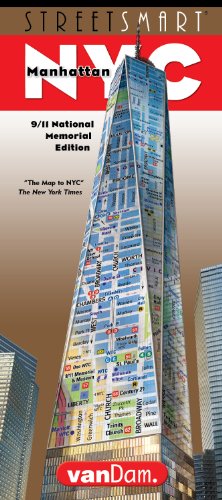
Laminated NYC Street mapLegible, easy to read, up to date 2017 edition
Manhattan City Street map laminated and folded to fit in pocket
NYC manhattan street and city subway map
New York City street map with attractions and subways
Description
VanDam's newly revised 2018 STREETSMART NYC 9/11Edition maps all top attractions including museums, major architecture, hotels, shopping destinations, the Memorial Museum grounds and the subway system for all of Manhattan at an immensely legible super-scale of 1:32,000 complete with 3-D building illustrations. Clear information design allows you to read the map from three feet away and has earned VanDam maps a place in the MoMA Collection. The map is film-laminated, accordion folded and pocket size.Coverage:
Manhattan Street Map 1: 32,000 Lower Manhattan Detail Map: 1:8,000 Manhattan Subway Map Upper Manhattan Map 1: 33,000
Dimensions: 4 x 9 folded, 9 x 24 unfolded, fits into shirt pocket or purse.
STREETSMART NYC 9/11 is so legible you will instantly understand how The City connects to all its parts. From God's perspective to the most minute details. For example: you are looking to hike from the Conrad Hotel to Castle Clinton, searching for elevator access on the High Line, meeting friends at the Hudson theater in Times Square, maneuvering the shifting grid of the West Village, shopping the Meat Market, trekking to Hamilton Terrace in Harlem, looking for the uptown exit from the FDR Drive onto the Brooklyn Bridge or just wanting to understand how the subway connects with ferries along the East River. This map makes it easy and you an instant New Yorker. Stephan Van Dam, the map's designer and publisher has been Manhattan-based for 40 years and knows NYC inside out.
STREETSMART NYC 9/11 includes the entire island plus a stunning dimensional detail of Lower Manhattan with historic walks around the 9/11 Memorial grounds and through the maze of the Financial District clearly marked. The map scale of 1:8,000 makes you feel you are there with 3D buildings illustrations as your compass. All subway stops are marked by their respective line in context right on the main map and on a separate subway overview so you know both the local details and understand the larger system. There is a Manhattan address finder to find any address in New York City. Locals refer to Manhattan, the most densely populated of the five boroughs, as New York City or just The City. The other four boroughs the Bronx, Brooklyn, Queens and Staten Island are collectively known as The City of New York and are available as separate STREETSMART Maps.
STREETSMART NYC maps are updated three to four times a year and more current than any other map available. Its film lamination is extra durable and will last you for your next trip. A customer recently suggested our maps are too good but we like quality that lasts. Simplicity reigns supreme to make complex cities clear and understandable. Our typography creates character and reveals the true bones of the vertical city. VanDam uses a letter grid to identify locations on maps - no confusing and cluttering K-28 or V-34s - its just the city from A-Z. Our covers map the icons of each city and turn them into collectible graphic art. Each sleek and laminated city map package opens to 24" x 9" and then easily folds down to 4" x 9" to snuggly fit into a shirt pocket or purse. Gain instant NYC STREETSMARTS and a sexy souvenir to boot!