Related posts
Feature
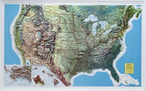
Three dimensional map of the United States brings the landscape to life, Each
Natural Color Relief map depicts topography realistically
Each region has a natural appearance
An exceptional visual and tactile reference
Dimensions: 34" X 21"
Description
See and touch the World, the United States, or smaller areas in 3 dimensions with colorful and informative raised relief maps. Raised maps let your students discover the surface of the earth in dramatic detail. Learn to know the topography and natural diversity of the entire country, or just your state. Mountains, valleys, plains, and other details are shown in three dimensions, leading to a better understanding of geography for all ages. Not only are raised relief maps are a great addition to any classroom, they can look great in your office, home or library too. They are made of sturdy vacuum-formed vinyl that enables years of use.